



Login
Get Instant Pricing On 23,000+ Aircraft

>
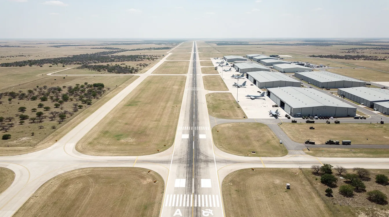
Robert Gray Army Airfield - identified by the ICAO code KGRK and the IATA/FAA code GRK - is the joint-use airfield that serves both Fort Hood (now Fort Cavazos) and the greater Killeen, TX area. KGRK is the ICAO code that identifies Robert Gray Army Airfield in aviation contexts, and can also refer to a radio station call sign. For military personnel, their families, corporate executives, and government contractors moving through Central Texas, KGRK can refer to both an aviation identifier and a radio station call sign, but in the aviation world it identifies Robert Gray Army Airfield clearly and specifically. The K in KGRK designates it as a U.S. airport according to ICAO standards, placing it squarely within the Federal Aviation Administration's regulated airspace system.
This guide is intended for military personnel, their families, business travelers, and anyone planning to use KGRK for travel to Central Texas. Understanding KGRK's unique joint-use operations and travel logistics is essential for efficient and secure travel in the region.
KGRK is located within the Fort Cavazos military reservation, roughly 6 miles southwest of the city of Killeen. It serves both military air traffic patterns and commercial operations, making it one of the few joint-use fields in Texas where Army aviation and civilian passenger service coexist daily. KGRK supports U.S. Army aviation operations alongside commercial flights, and it serves both military and commercial aviation with a single long runway, 24-hour tower, and modern instrument approaches.
For travelers using a platform like Jettly, KGRK offers a direct gateway into a region that would otherwise require a lengthy drive from Austin-Bergstrom or Dallas/Fort Worth. The airfield - also referenced as Robert Gray AAF or simply Robert Gray in pilot communications - handles over 84,000 annual operations and supports everything from helicopter training sorties to Embraer 175 regional jet service.
ICAO: KGRK | IATA/FAA: GRK
Primary role: Joint civil–military airfield for Fort Hood Killeen
Runway: 9,997 feet, supporting heavy transport and large business jets
Commercial carrier: American Airlines (to DFW)
Nearby airports: Austin-Bergstrom (AUS), Waco Regional (ACT), Dallas/Fort Worth (DFW)
Charter advantage: Minimal ground travel for Fort Hood–area passengers
A quick note for readers who arrived here searching for "KGR" in a marketing context: the Keyword Golden Ratio is a strategy for SEO using low-competition keywords, calculated by dividing the number of allintitle results by local monthly search volume. An excellent KGR is ≤ 0.25, indicating low competition, and it focuses on long-tail and niche queries for higher conversion rates. KGR is applicable to keywords with monthly search volume of 250 or fewer. This article, however, is about the airfield - not the SEO metric.
The airport is named after Robert "Bob" Gray, a WWII pilot who served as a co-pilot during the famous Doolittle Raid over Tokyo on April 18, 1942. Captain Gray, born in 1919 in Killeen, was later killed in combat operations in the China-Burma-India theater in October 1942.
The airfield was originally constructed by the Air Force as Gray Air Force Base during the Cold War, featuring underground fuel storage exceeding one million gallons and ramp areas designed for strategic bombers. In October 1963, the USAF transferred the facility to the U.S. Army, and it was officially redesignated Robert Gray Army Airfield. By 1969, the adjacent "Killeen Base" was renamed West Fort Hood, but the airfield retained its namesake.
Fort Hood itself was redesignated Fort Cavazos in 2023, though "Fort Hood" remains the dominant reference in aviation charts, NOTAMs, and commercial branding. The RGAAF airfield pavement has been maintained through successive upgrades to support both military rotary-wing operations and fixed-wing commercial service.
April 1942: Capt. Robert Gray participates in the Doolittle Raid.
October 1963: USAF transfers airfield to U.S. Army; Robert Gray Army Airfield designation becomes official
1969: Killeen Base redesignated West Fort Hood
2004: Commercial airline service introduced to Killeen regional passengers
KGRK is located 6 miles southwest of the city of Killeen, positioned on the southern edge of Fort Cavazos between Austin and Waco. The primary access route runs along Clear Creek Rd from the civilian side, with base roads connecting directly from Fort Hood's interior gates.
The functional catchment area extends across Bell County and into neighboring counties, covering military personnel, service families, regional businesses, and college communities near Belton and Temple. The Clear Creek corridor provides the most direct civilian approach to the terminal.
Killeen downtown: ~15–20 minutes by car
Fort Hood/Fort Cavazos main gate: ~10–15 minutes
Copperas Cove: ~30 minutes
Harker Heights and Belton: ~20–35 minutes
Austin-Bergstrom (AUS): ~1.5–2 hours by car
Dallas/Fort Worth (DFW): ~3 hours by car
For charter customers using Jettly, ground transportation - including rental cars, private car services, and pre-booked transfers - can be coordinated through the platform, and its airport locator tool helps match your trip to the most convenient airfield in the region. This is especially useful for passengers heading to Box C Killeen area or directly onto the base, where security procedures may require advance coordination.
The main runway, designated 15/33, provides the backbone of KGRK's operational capability. The airport has the longest primary runway of 9,997 feet and a width of 200 feet, surfaced with asphalt over concrete. This length comfortably accommodates wide-body aircraft movement, large-cabin business jets, and military transport aircraft.
KGRK has an elevation of 1,015 feet MSL, which - combined with Central Texas summer heat - can push density altitude high enough to affect takeoff performance for heavy jets. Fuel available at KGRK is jet only, supporting both military refuel ops and civilian charter arrivals.
KGRK operates 24 hours with a control tower, and the airfield includes conc areas for aircraft parking, a civ ramp for commercial and general aviation use, and a south ramp authorized for military operations, all of which can accommodate a wide range of private charter aircraft depending on mission needs. Ramp access procedures differ between the civilian and military sides.
Runway 15/33: 9,997 × 200 ft, asphalt/concrete
Elevation: 1,015 ft MSL
Fuel: Jet only
Navigation aids: ILS on both runway ends, RNAV (GPS) approaches, localizer, PAPI, MALSR lighting
Tower: 24/7 operations
Wide-body aircraft movement: Supported with coordination; wide-body aircraft require advance notice
Taxiways: Twy B, Twy C, Twy D, and connectors including Twy B fr C
De-ice capability: Available for winter operations
Water svc: On-field
Clsd circuit TV opr: Active for security monitoring
Follow me: Ground marshal personnel provide follow me vehicle guidance for unfamiliar operators; ground marshal personnel assist with parking
Based on FAA fiscal year 2024 data, the operations mix breaks down as follows: ~73,587 military operations, ~9,941 airline operations, and ~1,102 general aviation movements - totaling roughly 84,630 annual operations. About 47 aircraft are based at the field.

The traffic pattern at KGRK is shaped by its joint-use nature. Military operations - including extv copter sod ops and extv uas acft training - account for more than 85% of all movements. The TFC PAT ALT left configuration applies to standard patterns, with TFC PAT ALT varying by aircraft category. West TFC flow is common during prevailing wind conditions.
KGRK sits within class D airspace, controlled by the on-field tower, and pilots must establish contact with Killeen Radio or approach control before entry. DoD acft rqr class clearance applies to military movements, and civil acft ctc amgr (civil aircraft contact airfield manager) for non-scheduled arrivals. Remote briefing svc avbl through the base operations office.
The Federal Aviation Administration publishes instrument procedures for KGRK on a 28-day cycle. As of the current cycle, instrument procedures are valid from October 1 to October 29, 2026, effective at 0901Z through 0900Z, respectively. Pilots must carry current charts. Published approaches include ILS for both runway 15 and 33, RNAV (GPS) procedures, and localizer approaches - all of which give charter operators high reliability even in marginal weather.
ILS approaches: Both runway 15 and 33
RNAV (GPS): Published for both ends
Fr twy: Taxiway access from runway via designated exits
Wx vis obst rstd: Weather and visibility can restrict operations during convective activity
Wo conspicuous mrk: Some taxiway markings noted in NOTAMs
E rstd: Certain areas restricted during military exercises, except emergency arrivals
USDA Ag Inspection: May apply for certain international or agricultural-origin flights
For charter customers, these capabilities mean that a flight into KGRK rarely gets cancelled due to weather alone, which is a major consideration when comparing the best private jet charter companies and the reliability they can offer into regional airports like this. The 24-hour tower and precision approaches keep schedules reliable.
American Airlines is currently the sole scheduled commercial carrier at Robert Gray AAF, operating regional flights to Dallas/Fort Worth International (DFW) via its regional brand using Embraer 175 aircraft. Approximately 37 non-stop flights per week connect Fort Hood Killeen to the DFW hub, with flight times averaging about one hour.
United Airlines ceased service at GRK in January 2022, citing crew shortages and post-pandemic strategic shifts. This left American as the only commercial option, making Fort Worth and Dallas connections the primary commercial pathway for Killeen travelers.
From DFW, passengers can connect to virtually any domestic or international destination, but travelers who simply want to get a seat on a private jet easily may find that charter or shared options into KGRK are more time-efficient than complex airline routings. But for travelers with tight schedules or specific timing needs, nearby airports offer alternatives:
|
Airport |
Code |
Distance from KGRK |
Drive Time |
Best For |
|---|---|---|---|---|
|
Austin-Bergstrom |
AUS |
~100–120 miles |
1.5–2 hrs |
Wide commercial selection |
|
Waco Regional |
ACT |
~60 miles |
~1 hr |
Limited commercial |
|
Dallas/Fort Worth |
DFW |
~200+ miles |
~3 hrs |
Major hub connections |
|
Skylark Field |
ILE |
~8 miles |
~15 min |
GA/small aircraft |
From Jettly's perspective, KGRK is the clear choice when the destination is Fort Hood or Killeen. When clients are closer to Austin, private jet charter in Austin, Texas, or Dallas, Texas,s may be more efficient, while those connecting through the Southeast might route via private jet charter in Atlanta, Georgia, before positioning to Central Texas.
Central Texas weather directly affects flight planning at Robert Gray Army Airfield. Summers push temperatures past 95–100°F, raising density altitude and reducing aircraft performance. Spring and early fall bring convective thunderstorms that can force ground delays, which may influence whether passengers opt for shared charter flights versus full charters when building schedule buffers into their itineraries. Winter cold fronts occasionally drop ceilings and visibility.
Operators rely on METAR and TAF reports to plan arrivals and departures. A typical METAR observation might read: METAR KGRK 220155Z auto 00000kt 10sm clr 21 08 A3016 rmk ao2 slp207 t02050075. Breaking this down: 220155Z indicates the 22nd day at 0155 Zulu; auto 00000kt 10sm clr shows calm winds, 10 statute miles visibility, and clear skies. The 21 08 A3016 rmk AO2 segment reports temperature, dew point, altimeter setting, and automated station remarks. The full string - 00000kt 10sm clr 21, followed by 10sm clr 21 08, then clr 21 08 a3016, then 21 08 a3016 rmk - is read sequentially by dispatchers.
TAF forecasts follow a similar structure. A sample TAF might include segments like 09009kt 9999 skc qnh3013ins tx28 2120z tn13 2212z, indicating winds from 090 at 9 knots, visibility 9999 meters, skc qnh3013ins tx28 2120z tn13 forecast maximum 28°C at 2120Z and minimum 13°C at 2212Z. A later group might read 11009kt 9999 skc qnh3014ins wnd 33006kt aft 2208, showing skc qnh3014ins wnd 33006kt aft 2208 - a wind shift to 330 at 6 knots after 2208Z. The 9999 SKC QNH 3014 INS WND and 9999 SKC QNH 3013 INS TX28 groups confirm continued clear conditions. The OWS Barksdale AFB provides supplemental weather support for military operations.

With nearly 10,000 feet of runway and full instrument capability, KGRK handles everything from light jets and turboprops to heavy-cabin aircraft, making it a strong home base for travelers who rely on private jet memberships to manage frequent trips into Central Texas. Jettly connects travelers to certified charter operators able to fly into the field, offering instant pricing and digital aircraft comparison without the commitment of jet cards or fractional ownership, while still giving frequent flyers the option of structured jet card programs when predictable hourly rates are a priority.
Key reasons travelers choose KGRK for private charter—and why tools like Jettly’s jet card flight cost estimator matter when pricing routes in and out of Central Texas—include:
Proximity: Direct access to Fort Hood and Killeen without a 2–3 hour drive from Austin or Dallas
Schedule flexibility: Depart on your timeline, not the airline's
Mission variety: Military family visits, government contract travel, corporate meetings, emergency transport, and even cost-sharing options through crowdsourced private jet flights and shared empty seats on suitable routes
Aircraft range: Light jets for short hops to DFW, super-midsize or heavy jets for Washington D.C. or coastal hubs
A typical booking flow on Jettly: get an instant quote, compare aircraft by category - light, midsize, heavy, turboprop - using Jettly's choosing the right jet guide, review broader industry context via a comprehensive list of charter airlines and private aviation options, verify civilian or base-side terminal access, arrange ground transport, and confirm departure. The south ramp handles military-side arrivals, while the civ ramp serves charter and commercial traffic.
Arriving at Robert Gray Army Airfield on a charter flight, passengers deplane at the civilian terminal side. The terminal is compact - far fewer gates and lines than a major hub, which means faster processing, and travelers can enhance the onboard experience with tailored menus through Jettly Eats in-flight catering on qualifying charters. Baggage handling is straightforward.
For passengers entering Fort Cavazos, the process differs based on credentials:
Military ID holders: Proceed through base gates with standard access
Civilian visitors: Require advance sponsorship, valid government-issued ID, and vehicle registration for gate entry
Charter crews: Must coordinate with base operations; ground marshal personnel may direct aircraft to designated parking
Ground transportation options include rental cars on-site, private car services in Killeen, and pre-booked transfers. Hotels in Killeen, TX are concentrated within 5–10 miles of the terminal, and frequent flyers weigh KGRK’s access and costs against NetJets alternatives like Jettly when deciding how to structure their private travel programs. For cost transparency on charter travel, Jettly provides estimates that factor in positioning, fuel, and landing fees.
KGRK's joint-use status introduces planning variables that standard civilian airports don't have. During military exercises, certain ramp areas and airspace segments may be restricted. Charter operators should confirm coordination windows and any prior permission requirements through base operations.
FAA compliance: Jettly works exclusively with Part 135–certified operators meeting FAA safety audits and insurance standards, whether you book directly through Jettly or via partner operators such as Dexter Air Taxi
Runway performance: Hot weather at 1,015 ft elevation demands careful weight and fuel calculations; private jet charter costs may reflect fuel surcharges for density-altitude-affected departures, especially on longer-stage flights such as those to or from Houston, Texas
Base access: Share military sponsorship or security clearance needs early in the booking process if you’re routing via KGRK from international gateways such as Bangalore, Karnataka
Alternates: Austin-Bergstrom and DFW serve as standard alternates if weather or operational restrictions close KGRK, and long-haul itineraries to hubs like Chennai, Tamil Nadu often connect via these larger fields when Central Texas is the origin or final stop, and platforms like Zenflight within the Jettly ecosystem can help reposition aircraft when diversions are required
Civil acft ctc amgr: Non-scheduled civilian aircraft must contact the airfield manager before arrival; those referring clients or readers to this kind of service can benefit from Jettly’s ULTRA High Ticket affiliate program to earn on qualifying bookings
Exc emergency: Restricted areas remain closed to all traffic except emergency operations, in which case alternates across the wider region—including options like private jet charter in Kolkata, West Bengal, and other international gateways—may become part of contingency planning for repositioning aircraft
KGRK - Robert Gray Army Airfield - is Central Texas's most direct gateway to Fort Hood, Killeen, and the surrounding region. Its 9,997-foot runway, modern instrument procedures, and 24-hour tower make it operationally capable for aircraft ranging from turboprops to heavy business jets. With American Airlines providing commercial connectivity to Fort Worth and Dallas via DFW, and private charter filling the gaps in schedule and destination flexibility, KGRK serves a role that few joint-use airfields can match.
For travelers who move regularly between Central Texas and major hubs - whether for duty, business, or family - private charter through Jettly eliminates the layovers, long drives, and rigid schedules that come with commercial options. The platform's transparent pricing, broad aircraft access, and digital booking process are built for exactly this kind of mission: get in, get out, save time.
Ready to fly into Central Texas on your schedule? Explore flight options or request a quote at jettly.com.
Share this post:
Jeff Ryan Serevilla
Oct 21, 2026
|
5
min read
Discover tips and trends in the industry.
5
min read
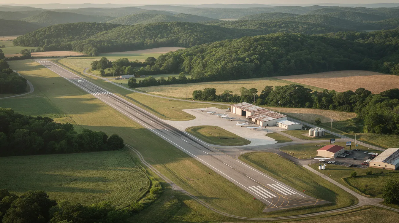
KLBO – Floyd W. Jones Lebanon Airport Private Jet Charter Guide
Floyd W. Jones Lebanon Airport (KLBO) is a premier general aviation airport in Lebanon, Missouri, catering to private jet travelers. With a 5,000-foot runway and dedicated FBO services, it offers a convenient alternative to larger airports, ensuring faster turnarounds and less congestion for corporate and leisure travelers alike.
Read More
5
min read
Flight Tracker FlightAware: How It Works, What It Shows, and When to Use Jettly Instead
FlightAware is a leading flight tracking platform that provides real-time data on commercial and general aviation flights. It offers features like live maps, flight status updates, and historical data, making it ideal for travelers and aviation enthusiasts. However, for those needing to book private flights, Jettly serves as a complementary service, offering access to a vast inventory of aircraft and transparent pricing.
Read MoreStay updated with our latest insights and tips to elevate your journey with us.
MEMBERSHIPS AND ASSOCIATIONS



Disclaimer: Jettly operates as a charter broker, offering access to a global digital jet charter marketplace. Jettly is not a direct air carrier and does not own or operate aircraft. All advertised flights are conducted by third-party air carriers that are fully licensed and hold the appropriate Part 135 or Part 121 certifications issued by the Federal Aviation Administration (FAA) or equivalent regulatory authorities under U.S. or foreign law. Jettly complies fully with the U.S. Department of Transportation's Part 295 and Part 298 Charter Broker regulations. Jettly does not carry additional liability insurance. Passengers are covered by aircraft operator insurance. TICO: 50023770


