


Login
Get Instant Pricing On 23,000+ Aircraft

>
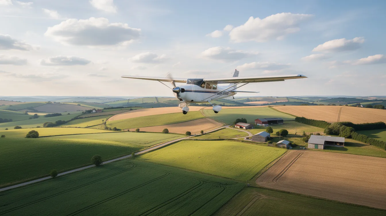
Cross-country flying is one of the most rewarding milestones in aviation. Whether a student pilot is navigating beyond the local practice area for the first time or a traveler is booking a private jet from New York to Los Angeles, the concept remains the same: flying a meaningful distance between two or more airports, across varied terrain and airspace. This guide covers everything from regulatory definitions and flight training requirements to practical planning steps and how private charter platforms make long cross-country flights faster and simpler.
A cross country flight typically means flying at least 50 nautical miles from the departure airport, and that threshold matters for pilot certificates, insurance, and flight planning.
Cross country flights are central to both private pilot and commercial pilot training, including solo cross country requirements and accurately logging cross country time.
Safe cross country flight planning under VFR covers route selection, weather, fuel, alternate airports, and creating a practical frequency log and navigation log.
Private jet charter platforms like Jettly make long cross-country trips (e.g., New York–Miami, London–Nice, Toronto–Vancouver) faster and simpler than flying commercially.
For travelers ready to skip the airline hassle, Jettly offers instant quotes and access to over 20,000 aircraft at jettly.com.
In practical terms, cross country flying means leaving the local flight area and traveling to another airport, usually across different airspace classes and terrain. A cross country flight is defined as over 50 nautical miles from the departure point under most Federal Aviation Administration (FAA) rules, though the exact distance threshold varies by certificate type and jurisdiction.
Here are the common regulatory benchmarks:
Federal Aviation Administration (FAA) (U.S.): A straight-line distance of at least 50 NM from the departure airport to the landing point is required to log cross-country time toward most certificates, per 14 CFR § 61.1.
EASA (Europe): Training flights often require a pre-planned route of at least 150 NM total, with full-stop landings at different aerodromes for specific licenses.
Everyday usage: Pilots may call any trip "cross country" if it goes beyond the local area, even if it doesn't meet license-logging criteria.
A concrete example: a flight from Van Nuys (KVNY) to Santa Barbara (KSBA) covers about 46 NM and would not meet the FAA's 50 NM threshold, while Van Nuys to San Luis Obispo (KSBP) at roughly 122 NM clearly qualifies.
Cross-country flying matters because it builds real-world navigation, communication, and decision-making skills. It is required to qualify for a private pilot certificate, a commercial pilot certificate, and for an instrument rating. It is also essential context for student pilots learning the craft and travelers booking longer-distance private flights.
Cross country time is a legal and logbook concept, and it does not always match casual pilot usage of "cross country flight." The FAA defines cross country flight with specific conditions: a flight conducted in an appropriate aircraft, including a landing at a point other than the original point of departure, using navigation systems to navigate the route. Cross country flight time requires navigational ability demonstrated through dead reckoning pilotage, radio aids, or electronic navigation aids.
Key distance thresholds to understand:
For a private pilot certificate or commercial certificate, the straight line distance from the point of departure to the furthest landing point must exceed 50 NM.
For a sport pilot certificate, the minimum drops to 25 NM (or 15 NM for a powered parachute category rating or rotorcraft category rating).
Cross-country flights must include a landing at a different airport than the departure airport.
The minimum distance for cross country flight varies by pilot certificate and particular rating.
Consider this scenario: depart Orlando Executive (KORL) and land at Daytona Beach (KDAB, about 43 NM). This does not count toward the 50 NM requirement for a private pilot certificate, even though pilots might informally call it cross country.
Under EASA rules, training organizations specify which flights count, often requiring routes of at least 150 NM with landings at different aerodromes. Pilots often use two logbook columns: one for all flights they personally consider cross country, and another for flights that legally count as cross country time toward a certificate or rating. Accurate logging matters-mislogged cross country time can delay certification milestones.
|
Certificate Type |
Minimum Distance for Cross Country Time |
Landing at Different Airport Required |
Notes |
|---|---|---|---|
|
Private Pilot |
50 NM |
Yes |
Includes solo and dual cross country flights |
|
Commercial Pilot |
50 NM |
Yes |
Higher total hours required |
|
Sport Pilot |
25 NM (15 NM for powered parachute) |
Yes |
Lower distance for sport pilot category |
|
EASA (Europe) Training |
Typically 150 NM total route |
Yes |
Includes full-stop landings at multiple aerodromes |
Cross country flights fit into the pilot training syllabus as the bridge between local flight maneuvers and real-world independence. In the U.S., Canada, and Europe, student pilots typically complete dual cross country flights with a flight instructor first, then move to solo cross country flights once demonstrated cross country proficiency is confirmed.
Typical FAA-style training milestones include:
One or more dual cross country flights with an authorized instructor, including at least one flight over 100 NM total with full-stop landings at three airports.
Solo cross country privileges require at least 5 hours of solo cross country time, including a long cross country flight of at least 150 NM total with full-stop landings at three airports (one leg over 50 NM from the original point).
The FAA mandates specific hours for cross-country flight experience, and exact numbers depend on the rule set and aircraft category.
The educational goals are clear: moving beyond the traffic pattern and local practice area into unfamiliar airspace and terrain. Unfamiliar airports present challenges due to different traffic patterns and landing procedures. Student pilots build confidence with dead reckoning, pilotage, and navigation systems like VOR, GPS, and RNAV. They practice real-world radio work with multiple ATC facilities and uncontrolled airports.
Common student-pilot cross-country routes include Phoenix Deer Valley (KDVT) to Flagstaff Pulliam (KFLG), Chicago DuPage (KDPA) to Madison (KMSN), and Oxford (EGTK) to Gloucester (EGBJ) in Europe. Cross-country time later matters for advanced qualifications: minimum cross-country hours for the commercial pilot license, and cross-country experience required before attempting an instrument rating, long IFR cross-country under instrument flight rules.
A solo cross country flight means a student pilot flying as sole occupant on a cross country route, under a specific instructor endorsement, usually for the first time beyond local airspace. This is distinct from a local flight in both scope and responsibility.
Before a solo flight on a cross-country route, the instructor must review and sign off the complete flight plan, including route, performance, and weather. The student must demonstrate competence in navigation, radio communication, traffic pattern procedures, appropriate maneuvers, and emergency procedures. Endorsements are route-specific and time-limited under rules like 14 CFR 61.93. Pilots must meticulously evaluate operational factors before a flight, and pilots must gather information before departure, including NOTAMs.
A practical solo cross country planning checklist includes:
Full preflight weather briefing using aeronautical weather reports (METARs, TAFs, prog charts, winds aloft)
Calculation of fuel consumption, weight and balance, and aircraft performance charts for departure and destination runways, including computing takeoff and landing roll distances
Identification of alternate airports and divert options, including fuel and runway considerations
Review of proper operational procedures and operating practices for each airport
For a first cross-country flight, a triangle route with three airports about 50–70 NM apart works well. Choose airports with clear runway layouts and services. The right mindset is conservative decision-making: "If in doubt, land and reassess." Be willing to delay or cancel if crosswinds, ceilings, or visibility deteriorate. Have an "abort point" planned for each leg.
Good cross country planning is the difference between a safe flight and a stressful one. Weather conditions should be reviewed for current and forecasted information before every departure, and route selection deserves careful thought.
Route selection: Choose a route that balances direct distance with airspace simplicity and terrain safety. Consider terrain when planning your cross-country flight route. Use aeronautical charts, waypoints, and prominent features (rivers, highways, ridgelines) for pilotage. Pilots need to check for controlled airspace and special use airspace along the planned route. Identify alternate routes in case of weather changes during flight. Example: planning a cross-country from Dallas Love Field (KDAL) to Houston Hobby (KHOU) means managing Class B airspace, with diversion airports planned for in case of weather deterioration.
Weather: Use official aviation weather sources for forecasts and METARs. Check NOTAMs and weather for departure and destination airports. Weather variability requires continuous monitoring of METARs and TAFs throughout the day. Key factors include ceiling, visibility, convective activity, freezing levels, turbulence, and surface crosswinds. Set clear "go/no-go" and "continue/land" decision points along the route. Critical weather situations demand conservative action.
Fuel planning: Calculating precise fuel burn requires adding mandatory legal reserves. For a Cessna 172 burning 8–10 gallons per hour, plan with at least 45 minutes of reserve. Consider wind conditions when calculating fuel requirements-headwinds, climbs, and diversions add significant fuel time. Have a primary refueling plan and backup options. Challenges of cross-country flying include fuel and weight planning, especially on multiple legs. Suggest planning refueling stops one to two legs earlier than the aircraft's theoretical range.
Performance matters too: density altitude impacts for hot/high airports (like Denver Centennial KAPA in July) reduce climb rates and increase ground roll. Always verify minimum safe altitudes over terrain and hazardous terrain features.
Cross-country flying is about blending traditional navigation skills with modern avionics, while keeping communication clear and structured. Cross-country flights require navigation skills like map reading, and navigation aids include GPS, radio stations, and visual landmarks. Airspace complexity requires situational awareness to avoid infringements.
Key navigation methods include:
Pilotage: Using visual references like coastlines, highways, lakes, and towns to maintain situational awareness
Dead reckoning: Time, heading, and airspeed calculations using flight instruments and an E6B flight computer for straight and level flight segments
Radio navigation: VOR radials, DME, and basic RNAV concepts using electronic navigation aids
GPS and moving-map apps: Powerful but carry risk of over-reliance; always maintain backup navigation ability
A simple navigation log should include columns for waypoints, headings, distances, estimated times en route, and fuel checks. Update it with actual times and groundspeeds during the flight.
Review communications procedures and frequencies before departure. Filing a flight plan is highly recommended for cross-country flights. Have a frequency log ready with order-of-use: ATIS/AWOS, Ground, Tower, Departure, en route sectors (staying within one controller's area until handed off), Approach, and CTAF/UNICOM.
A frequency log is a simple one-page list where each entry contains the facility name (e.g., "Orlando Approach East"), frequency (e.g., 120.15), purpose (ATIS, Ground, Tower, Departure, Center, CTAF, AWOS), and notes on when to switch (after the departure leg, approaching a waypoint, etc.).
For a 150 NM VFR cross country, the flow looks like this:
Departure airport ATIS, then Ground, then Tower, then Departure
En route sector frequencies (Center) as you cross through each controller's area
Destination AWOS/ATIS, then Approach, then Tower or CTAF
Having this physical or digital log reduces cockpit workload, especially during solo cross country time when workload is at its peak.
Flight following means requesting VFR radar advisories and traffic information from ATC. Example phraseology: "Kansas City Center, Cessna N123AB, VFR request," followed by aircraft type, position, altitude, and destination departure point.
Controllers hand off from one sector to another. On longer cross-country flights, expect new frequency assignments approximately every 50–100 NM. Realistic expectations matter: ATC may decline during high workload, pilots still remain responsible for terrain and traffic separation under VFR, and flight following does not replace a filed flight plan for search-and-rescue purposes. Student pilots and lower-time private pilot holders should use flight following on most cross-country flights to build radio confidence and maintain situational awareness.
As flights extend over remote terrain or water, backup equipment and planning become critical. Fatigue management is a challenge on longer cross-country flights, and planning for emergencies includes identifying alternate airports along the route. Successful cross-country flying teaches risk management and situation assessment.
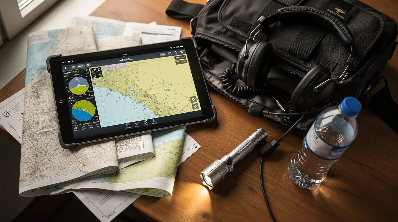
The "two is one; one is none" philosophy applies directly:
Redundancy: Carry two independent navigation devices (panel GPS plus tablet), two charging cables, spare headset batteries, and a backup flashlight. Flight instruments should be cross-checked regularly.
Emergency gear: First-aid kit, emergency blankets, water, high-energy snacks, fire starter, basic tools, and a whistle. For over-water segments, add life vests. For remote northern routes, consider a satellite messenger.
Flexible mindset: Pack an overnight bag for unexpected delays during flights. Carrying a compact bag with a change of clothes and basic toiletries reduces pressure to press on into deteriorating weather just to "get home." Review terrain and off-airport landing options along the route using high-level terrain profiles. Exercising recreational pilot privileges or recreational pilot privileges on cross-country routes still demands this level of preparation, as does any flight conducted beyond the traffic pattern.
Wake turbulence precautions should also be considered when operating near larger aircraft at unfamiliar airports, and pilots should review operational restrictions for each airport along the route.
Once pilots and travelers think in cross-country distances, private aviation becomes an attractive alternative to commercial flights. For those who want to fly cross country without the hassle of connections and security lines, charter platforms bridge the gap.
Jettly handles long cross-country flights by providing on-demand access to over 20,000 aircraft, from turboprops to long-range jets. The platform offers instant pricing and digital booking for domestic and international cross-country legs. Learn more about how private jet charter works through Jettly's booking process.
Typical cross-country charter use cases include:
Business: New York (Teterboro TEB) to Miami for multi-day meetings - see the NYC to Miami private plane guide
Leisure: Los Angeles (VNY) to Aspen (ASE) for winter trips, where terrain and aircraft performance matter
Canada: Toronto (YTZ) to Vancouver (CYVR), crossing the Rockies on a transcontinental private jet route
Europe: London to Nice for events like Cannes Film Festival week
Key advantages: time savings from avoiding security lines, flexible departure times, aircraft choice tailored to trip length, and the ability to depart from smaller local airports closer to the departure point.
Aircraft selection dramatically affects travel time, cost, comfort, and the number of required fuel stops on cross-country flights. Whether operated by owner-pilots or booked via a charter marketplace, choosing the best cross country plane is a critical decision.
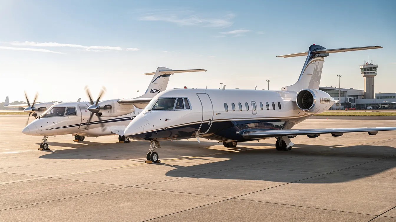
Key categories for cross-country missions:
|
Aircraft Category |
Typical Range (NM) |
Passenger Capacity |
Use Case Example |
Approximate Hourly Charter Rate (USD) |
|---|---|---|---|---|
|
Turboprops |
800–1,200 |
6–9 |
Regional trips, short to medium legs |
$1,200–$2,500 |
|
Light Jets |
Up to 1,500 |
4–7 |
Business trips, regional cross-country |
$2,500–$5,500 |
|
Midsize and Super-Midsize Jets |
2,000–3,000 |
6–10 |
Coast-to-coast U.S. flights |
$5,000–$8,000 |
|
Heavy and Long-Range Jets |
3,500+ |
10–18+ |
Intercontinental, nonstop long flights |
$11,000–$25,000+ |
How to choose depends on distance and required range, runway length and field elevation, passenger count and baggage needs (golf bags, skis, film equipment), and cabin comfort expectations for flights over 3–4 hours. Jettly's platform shows multiple suitable aircraft options for the same route, letting clients balance speed, cost, and comfort. For a detailed cost breakdown, try Jettly's charter cost estimator.
A powered parachute or sport pilot aircraft won't handle these distances, which is why knowing your next cross-country flight needs upfront helps match the appropriate aircraft to the mission.
Modern software has changed cross country operations for both pilots and passengers. For pilots and flight schools, electronic flight bag (EFB) tools handle route planning, weather overlays, performance calculations, and digital aeronautical charts. Digital logbooks simplify tracking cross-country time, solo cross-country flights, and endorsements - making it easy to log time accurately toward a private certificate or commercial certificate.
For charter customers, Jettly's digital booking and instant pricing reduce the time needed to quote and confirm cross-country itineraries. Travelers can compare multiple options from their phone, without broker back-and-forth.
Efficiency and environmental awareness matter too:
Right-sizing aircraft to the mission - using a turboprop instead of a heavy jet for a 300 NM cross country - cuts fuel consumption and costs
Carbon offset programs let operators and customers reduce the environmental footprint of long cross-country flights
Route optimization and payload balancing contribute to lower emissions per passenger
These FAQs address common cross-country questions not fully covered above, focusing on both pilot training and private charter travel.
Under typical FAA rules, the straight line distance between the departure airport and the furthest landing point must exceed 50 nautical miles for the flight to count as cross country time toward most airplane certificates. Longer requirements exist as separate milestones - for example, the 150 NM long cross-country flight with specific landings. Rules differ for a sport pilot certificate (25 NM) and a powered parachute category rating (15 NM). Always confirm current regulations and discuss planned routes with your flight instructor before flying and logging solo cross country time.
In many countries, VFR flight plans are recommended but not mandatory for all cross-country flights, except when crossing international borders or entering certain controlled airspaces. A VFR flight plan filed with flight service supports search-and-rescue. Requesting VFR flight following from ATC provides radar and traffic advisories but serves a different purpose. Lower-time pilots should file VFR flight plans and use flight following whenever practical, especially on solo cross country routes over water, mountains, or remote areas.
Consider terrain and obstacle clearance (at least 1,000–2,000 feet above obstacles), VFR hemispheric altitude rules (odd thousands plus 500 feet eastbound, even thousands plus 500 feet westbound in the U.S.), and winds aloft, turbulence layers, and icing risk. For example, choose 7,500 feet for an eastbound VFR cross country across flat terrain, or 9,500 feet and above over mountains. Compare multiple altitude options during planning to balance performance, comfort, and weather exposure.
Many midsize, super-midsize, and heavy jets can fly such cross-country routes non-stop, depending on passenger load, weather, and specific aircraft type (e.g., Challenger 350, Gulfstream G550, Global 6000). On some very long routes or with strong headwinds, a brief fuel stop may still be the most efficient option. Travelers can use Jettly to see which aircraft types can perform their desired cross-country route non-stop and compare pricing in real time.
Same-day and next-day cross country charters are often possible, subject to aircraft and crew availability and any permit requirements for international segments. Booking a few days in advance usually gives more choice and better pricing, especially during peak periods. Check real-time availability or book a same-day private jet for your desired cross-country dates and route at jettly.com.
Cross-country flying is central to pilot training and licensing, building navigation and decision-making skills that define a competent aviator. Safe cross country flights rely on disciplined cross country planning, accurate logging of xc time, and good communication practices like using a frequency log and flight following. For travelers, private jet charter has turned long cross-country trips into a flexible, time-saving option, especially on routes poorly served by airlines.
Cross-country proficiency is built through disciplined practice, from a first cross-country flight in a Cessna to booking a Gulfstream coast-to-coast
Every next cross-country flight benefits from lessons learned on the last one
Jettly makes private cross-country travel accessible with instant pricing, aircraft variety, and digital convenience
Ready to experience private travel on your terms? Explore flight options or request a quote at jettly.com.
Share this post:
Jay Franco Serevilla
Aug 12, 2026
|
5
min read
Discover tips and trends in the industry.

5
min read
How Much Is Airplane Fuel? Jet Fuel Prices, Costs, and What They Mean for Private Flights
As of May 2026, airplane fuel prices in the U.S. range from $7.00 to $9.20 per gallon for Jet A, significantly impacting private flight costs. Understanding these prices is crucial for frequent flyers, as fuel constitutes a major portion of charter expenses. Jettly offers transparent pricing that incorporates real-time fuel costs to help travelers budget effectively.
Read More
5
min read
Private Jet Charter Colorado Springs: Fly Smarter with Jettly
Private jet charter in Colorado Springs offers a convenient and flexible travel solution for business and leisure travelers. With access to over 20,000 aircraft through Jettly, booking a flight is quick and hassle-free, allowing you to bypass commercial airline delays and enjoy tailored services. Experience the benefits of private aviation, including direct airport access and personalized itineraries.
Read MoreStay updated with our latest insights and tips to elevate your journey with us.
MEMBERSHIPS AND ASSOCIATIONS



Disclaimer: Jettly operates as a charter broker, offering access to a global digital jet charter marketplace. Jettly is not a direct air carrier and does not own or operate aircraft. All advertised flights are conducted by third-party air carriers that are fully licensed and hold the appropriate Part 135 or Part 121 certifications issued by the Federal Aviation Administration (FAA) or equivalent regulatory authorities under U.S. or foreign law. Jettly complies fully with the U.S. Department of Transportation's Part 295 and Part 298 Charter Broker regulations. Jettly does not carry additional liability insurance. Passengers are covered by aircraft operator insurance. TICO: 50023770


